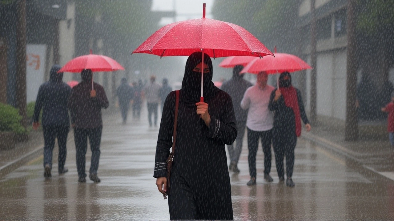
Kenya Meteorology warns of heavy downpours as 2025 Long Rains start
 Oct, 5 2025
When David Gikungu, Director of Kenya Meteorological Department issued an alert on 18 March 2025 from Nairobi, he warned that the country’s March‑April‑May “Long Rains” season had officially begun and heavy downpours could hit large swathes of the nation. The warning came just as the 2025 March‑April‑May Long RainsKenya met the meteorological trigger of 20 mm of rain over three consecutive days, a benchmark that KMD uses to declare the season’s onset.
Why does this matter? For most Kenyans, the Long Rains are the agricultural heartbeat – the period when crops are planted, water reservoirs fill, and food security gets a boost. But a sudden burst of rain can also turn roads into rivers and low‑lying fields into quicksand. That duality is why Gikungu’s alert carries both hope and a request for caution.
What the Long Rains Mean for Kenya
The Kenya Meteorological Department (KMD) explained that the season’s definition hinges on two conditions: a wet spell of at least 20 mm in three days, and a sustained pattern that mirrors historical averages. The department’s monitoring unit noted a clear uptick in rainfall from the week of 3–9 March 2025, especially across the southeastern lowlands where gauges recorded an average of 28 mm in a 72‑hour window.
By the following week, 10–16 March, the highlands west of the Rift Valley and the Lake Victoria Basin saw comparable spikes, cementing the official start of the Long Rains. In practical terms, farmers in those areas can now expect soil moisture levels to rise, reducing the need for supplemental irrigation.
Regional Forecasts and Expected Impacts
KMD’s regional outlook paints a patchwork of rain patterns. Western highland counties – Kakamega, Bungoma, Kericho, Trans‑Nzoia and Uasin Gishu – are slated for scattered morning showers that could turn into brief, heavy bursts. In the north‑west, Turkana and Samburu may see a mix of early‑morning drizzle followed by afternoon thunderstorms, a combo that often spawns flash floods in the low‑lying valleys.
Meanwhile, the eastern highlands – Nyandarua, Laikipia, Nyeri, Murang’a, Kiambu and the capital region – are forecast for occasional cloud cover with sunny intervals, a pattern that farmers describe as “rain on demand”. The twist is that isolated heavy bursts could still occur, particularly over the Rift Valley’s escarpments where orographic lift amplifies rain.
- Highlands West – morning showers, 10‑20 mm per event.
- North‑west (Turkana, Samburu) – mixed drizzle and thunderstorms, heightened flood risk.
- Highlands East – intermittent clouds, mostly dry spells.
- Lake Victoria Basin – steady rain through April, supporting maize planting.
Nyamira County, which released its own forecast on 17 February 2025, expects a "normal" distribution of rain with a peak in April. The county’s agricultural officers say that while most villages will see average totals, a handful could get above‑normal amounts – a scenario that could stress already‑saturated soils.
Advice for Farmers and Residents
“Stay alert, stay safe,” Gikungu urged during the press briefing. KMD recommends that households in flood‑prone zones monitor local radio updates and keep sandbags or other barriers ready. For farmers, the key is timing: plant early‑season crops like beans and sorghum now, before the heavier April showers arrive.
Community leaders in Kisumu and Eldoret have already organized emergency response drills, mirroring a model first piloted after the 2018 heavy‑rain event that caused extensive road damage. The drills focus on rapid evacuation routes, temporary shelters, and the distribution of clean drinking water – essential steps when flash floods turn streams into hazards.
Historical Context and Seasonal Variability
The Long Rains have a storied track record. Since the 1990s, Kenya’s average March‑May precipitation has hovered around 550 mm nationally, with the western highlands typically receiving the bulk. However, the past decade has seen more pronounced regional swings, a pattern scientists link to El Niño‑Southern‑Oscillation (ENSO) cycles and the Indian Ocean Dipole.
In 2020, for example, an early onset triggered a cascade of landslides in the Rift Valley, while 2022 saw a delayed start that squeezed planting windows for smallholder maize growers. The 2025 outlook sits somewhere in the middle – an early onset but with intensity that varies sharply from county to county.
Looking Ahead: What to Expect Through June
KMD’s long‑range models suggest the rains will linger into early June, with a gradual tapering off toward the end of the month. This extended window offers a second planting opportunity for fast‑growing vegetables, but also raises concerns about water‑borne diseases such as cholera, especially in densely populated urban slums.
Health officials in Nairobi have already pre‑positioned oral rehydration salts and are urging residents to boil water before drinking. Meanwhile, the Ministry of Agriculture is coordinating with KMD to issue weekly bulletins that pair rainfall data with crop‑growth recommendations – a synergy that could shave weeks off harvest times.
Key Facts at a Glance
- Alert issued: 18 March 2025 by David Gikungu, Director of KMD.
- Season officially started: week of 10–16 March 2025 (20 mm rain over three days).
- Regions most affected: Western highlands, Lake Victoria Basin, Rift Valley, north‑west counties.
- Projected end of season: early June 2025.
- Recommended actions: monitor official updates, prepare flood barriers, adjust planting schedules.
Frequently Asked Questions
How will the 2025 Long Rains affect smallholder farmers?
Most smallholders in the western highlands can plant early‑season crops now, taking advantage of the steady March‑April showers. However, those in flood‑prone lowlands should prioritize flood‑resilient varieties and consider raised beds to avoid water‑logging.
What regions are at highest risk of flash flooding?
The north‑western counties of Turkana and Samburu, as well as sections of the Rift Valley escarpments, face the greatest flash‑flood risk due to sudden thunderstorms that often follow early‑morning drizzle.
When is the peak of the Long Rains expected?
Meteorologists pinpoint the peak in mid‑April, when the Lake Victoria Basin and western highlands typically receive the bulk of their monthly totals.
What precautions should urban residents take?
City dwellers, especially in low‑lying neighbourhoods of Nairobi, should keep sandbags handy, avoid driving through flooded roads, and ensure water sources are boiled before consumption to prevent disease.
Will the rains extend beyond June?
Current models suggest a tapering off by early June, but occasional late‑season showers could still occur in the highlands, offering a brief window for a second planting round.
Adrish Sinha
October 5, 2025 AT 04:40Stay safe out there, the rains are coming!
Arun kumar Chinnadhurai
October 5, 2025 AT 23:33First off, keep an eye on the KMD bulletins-they're updating hourly. If you live in the western highlands, you can start planting beans and sorghum right away. For anyone near the Rift Valley escarpments, consider raised beds to avoid water‑logging. Sandbags are cheap and can be stacked quickly, so stock up before the streets turn into small rivers. And remember, boiling water is still the best defense against cholera this season.
Aayush Sarda
October 7, 2025 AT 03:20It is imperative that the populace recognize the gravity of the meteorological trigger announced by Director Gikungu. The 20 mm benchmark over three consecutive days is not merely a statistical footnote; it portends a shift in agronomic cycles. Consequently, agricultural extension officers must disseminate planting schedules with alacrity. Moreover, infrastructure planners should reassess drainage capacities in flood‑prone corridors. Failure to act decisively could exacerbate the socioeconomic fallout witnessed during the 2020 landslides. The government’s prior experience with the 2018 heavy‑rain episode should serve as a blueprint for rapid response. Citizens are urged to coordinate with local committees to pre‑empt flash‑flood scenarios. In essence, vigilance paired with proactive measures will safeguard both yields and lives.
Mohit Gupta
October 8, 2025 AT 07:06Wow, the rain is really coming down hard!!! I can feel the clouds gathering already!!! This is both exciting and terrifying, you know? Make sure you have your emergency kit ready!!!
Varun Dang
October 9, 2025 AT 10:53Friends, the onset of the Long Rains is a bright spot for many smallholder farmers across Kenya. By planting early‑season crops now, you can take full advantage of the moisture boost. It also gives you a buffer before the heavier April showers arrive, reducing stress on seedlings. Remember to rotate crops and use organic mulch to retain soil health. Keep an eye on local radio for updates-staying informed is half the battle won. Together, we can turn this season into a harvest success story.
Stavya Sharma
October 10, 2025 AT 14:40One must question whether the current public messaging truly reflects the on‑ground realities. The advisories often skim over the lack of proper drainage in rural hamlets. Such oversights can lead to preventable loss of life and property. It is incumbent upon authorities to provide concrete evacuation routes, not just generic warnings. Without these measures, the so‑called “precautionary advice” amounts to lip service.
rama cs
October 11, 2025 AT 18:26From an ontological perspective, the Long Rains embody a dialectic between abundance and vulnerability, a Sisyphean interplay of hydrological surplus versus infrastructural fragility. The epistemic frameworks employed by meteorologists, while robust, still grapple with stochastic variability inherent in ENSO dynamics. Thus, practitioners must recalibrate their prognostic models to accommodate non‑linear feedback loops. In essence, the phenomenology of rainfall transcends mere precipitation metrics, resonating within the sociocultural fabric of agrarian communities.
Monika Kühn
October 12, 2025 AT 22:13Oh great, just what we needed-more mud to step in.
Mayur Sutar
October 14, 2025 AT 02:00Hey folks, did you know that many of the western highland traditions celebrate the first rain with a communal dance? It’s a beautiful way to honor the land’s generosity. While we’re dealing with practical concerns, let’s not forget those cultural rituals that bring us together. They can also serve as informal checkpoints for community safety. So, maybe plan a small gathering after checking the forecast, keep the spirit alive.
Nancy Ortiz
October 15, 2025 AT 05:46Indeed, the hydrometeorological influx presents a quintessential conundrum for urban planners operating within the paradigm of infrastructural myopia.
Ashish Saroj( A.S )
October 16, 2025 AT 09:33Honestly, I think the hype around these rains is overblown!!! The data suggests only a marginal increase in total volume compared to previous years!!! Yet media outlets scream about disaster!!! Perhaps we should focus on long‑term water management instead of panic‑selling sandbags!!!
Ayan Kumar
October 17, 2025 AT 13:20Picture this: dark clouds rolling in like a cinematic villain, thunder booming as the ultimate soundtrack, and the streets suddenly turning into rivers! It’s like Mother Nature decided to throw a massive surprise party, but forgot to send out invitations! Everyone’s rushing, hearts pounding, trying to save their prized tomatoes! The drama is real, and the stakes? Your crops, your commute, your sanity!
Nitin Jadvav
October 18, 2025 AT 17:06Look, if you’ve got sandbags, great-use ‘em. If not, maybe improvise with old blankets. Just don’t wait until the water’s already ankle‑deep before you act. You’ve got this, even if the rain thinks otherwise.
chaitra makam
October 19, 2025 AT 20:53Quick tip: keep a waterproof container for your seeds and paperwork. It’s a small step that saves a lot of hassle later. Also, check the drainage in your yard before the heavy bursts hit. A little maintenance now can prevent a big mess later.
Amit Agnihotri
October 21, 2025 AT 00:40The warnings are vague and the preparations insufficient. Authorities must step up their game.
Surya Prakash
October 22, 2025 AT 04:26Another rain season, same old problems.
Sandeep KNS
October 23, 2025 AT 08:13It is with profound enthusiasm that I observe the nation’s collective preparedness for the impending deluge, a preparedness that, unsurprisingly, appears to consist chiefly of idle chatter and superficial assurances. One cannot help but marvel at the deftness with which officials tout “state‑of‑the‑art” monitoring systems while neglecting the most rudimentary of flood defenses. The allocation of resources toward glossy press releases is, of course, a masterstroke in public relations. Meanwhile, the very citizens who labor in the fields are left to contemplate whether their humble sandbags will suffice against torrents that dwarf their expectations. The cultural narrative that glorifies suffering as a rite of passage is, frankly, an antiquated trope that does little to mitigate actual risk. In addition, the overreliance on satellite imagery, whilst technologically impressive, fails to capture the nuances of local topography that dictate water flow. Such oversight is reminiscent of a surgeon operating with a telescope rather than a scalpel. Yet, the bureaucracy persists, ever‑faithful to its mandate of procedural perfection. It is commendable, really, how the ministries coordinate their weekly bulletins, each replete with optimistic phrasing that borders on the absurd. The populace, ever resilient, continues to heed advice that oscillates between “plant now” and “prepare for floods,” a dichotomy that would bewilder any seasoned meteorologist. Furthermore, the promised distribution of oral rehydration salts remains a phantom, as elusive as the promised end to the rains. One must also acknowledge the subtle art of shifting responsibility, expertly executed by juxtaposing agricultural imperatives with health warnings. In essence, the entire enterprise resembles a well‑choreographed ballet of optimism and denial. Nonetheless, should the rains indeed conform to historical averages, the nation may yet emerge with crops intact and spirits unbroken-a scenario that would undeniably vindicate the endless meetings and memoranda. Until such a miraculous outcome materializes, however, skepticism remains the most prudent companion.